
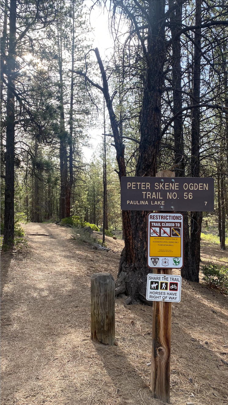
Peter Skene Ogden Trailhead to Paulina Falls Trail Run
WHEN: May 17, 2024
WHERE: Near La Pine, Oregon. Trail is accessed off of Hwy 97. From Bend, OR: Travel 23.5 miles south on Highway 97, then 2.8 miles east on Paulina Lake Road/County Road 21.
START/END: Peter Skene Ogden Trailhead
ROUND TRIP DISTANCE: 17.2 miles
TRIP TIME: 4.5 hours (I’m slow and the dogs wanted a lot of water breaks!)
ROAD CONDITIONS: Open
Trip Report:
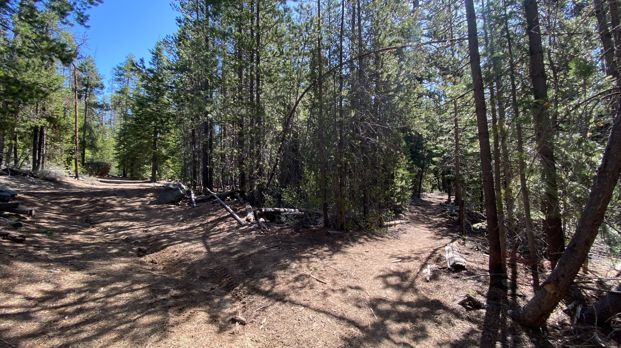
This is a beautiful, yet moderately challenging, out and back run that parallels Paulina Creek the entire way. Due to time constraints and warming temps, I chose to only do the run up to Paulina Falls, stopping just short of Paulina Lake for a total distance of around 17 miles. For a total vert challenge, the uphill portion of this trip can be extended an additional 2.8 miles, with 1600 feet elevation gain, up to Paulina Peak, for a round trip total distance of approximately 23 miles! Or, for an extreme added bonus, one can tack on the entire Crater Rim loop for a grand total of 37 miles with 4500 feet elevation gain! (Stay tuned for that trip report later this summer!)The trail is accessed from Peter Skene Ogden Trail Head. (From Bend, OR: Travel 23.5 miles south on Highway 97, then 2.8 miles east on Paulina Lake Road/County Road 21.) The parking lot is large and allows camping for reserved groups only, but parking for day use is free. The trail begins by crossing a bridge over Paulina Creek where it heads straight into the trees climbing gently and gradually uphill. For the most part, the trail stays on the North side of the creek and, if started early enough in the day, is in the shade until late morning. After that the sun can be brutal on humans and pups, and the sand can be super hot on doggy feet!
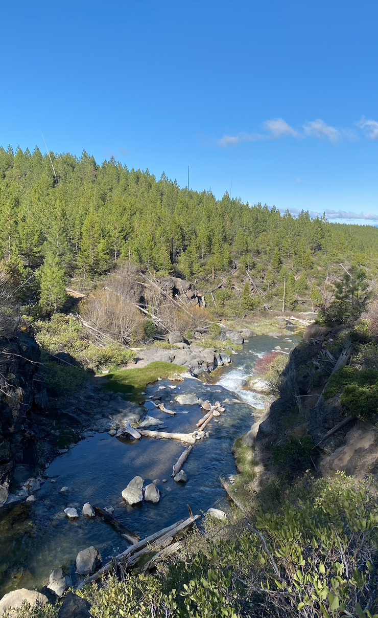
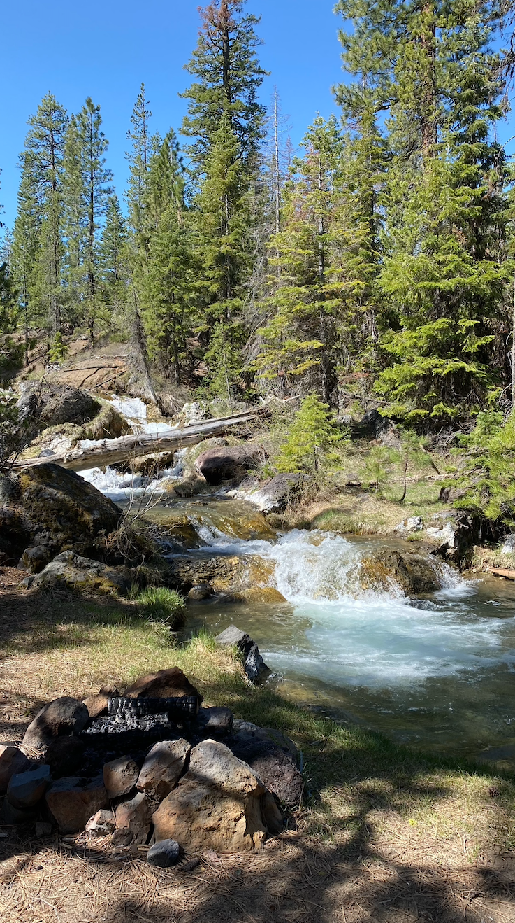
The trail up to Paulina Falls gains about 2000 feet elevation over approximately 8.5 miles. The first 4 or so miles are gentle with a rise of about 200 feet/mile, the remainder of the elevation is spread throughout the remaining 4.5 miles. The trail is 100% single track dirt and rock, with only a few sneaky roots and stubby sticks that could cause a Superhero moment if not seen! The terrain is soft, yet solid and 100% runnable! It’s hard not to be distracted by the beauty of the countless waterfalls along the way. This trail has ample areas for humans and pups to stay hydrated.
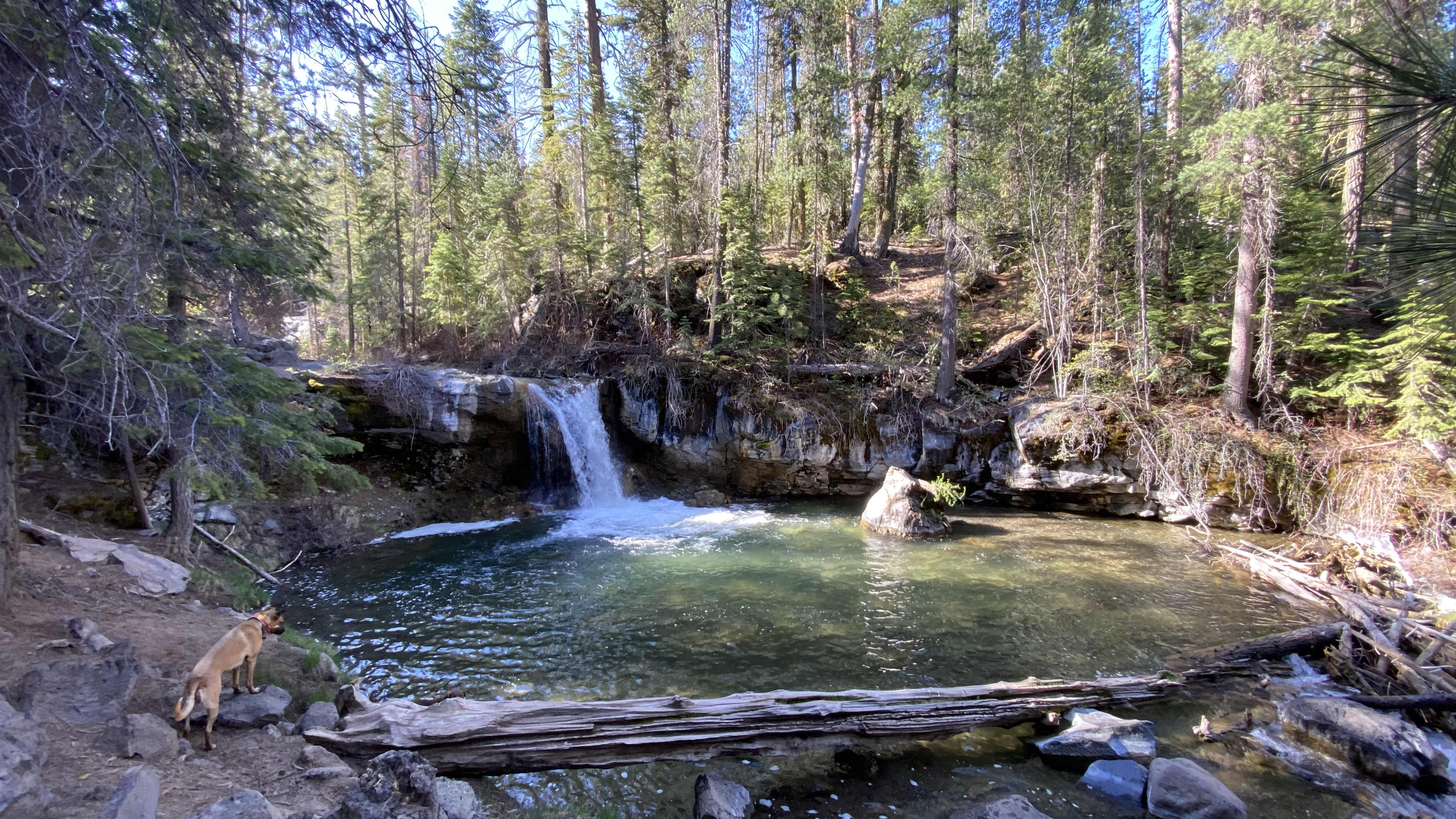
Watering Hole
I’d recommend keeping pups on leash except when taking swim breaks as there may be horses on the trail.
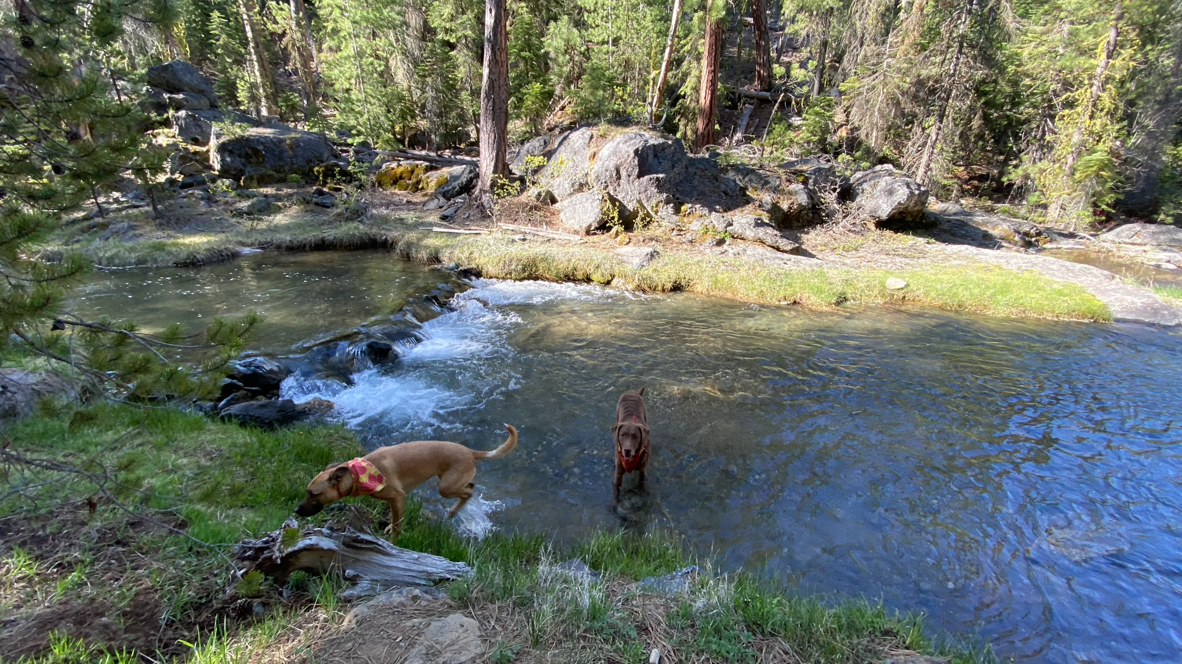
Doggy watering hole
At the 2.75 mile mark you will encounter McKay Crossing campground located across the creek. From there the trail continues uphill along the creek, again passing numerous waterfalls and one very nice viewpoint.
Waterfall at McKay crossing
McKay Crossing Campground Junction
High Viewpoint
Twin waterfalls
There is a junction at mile 6 where one can choose to stay on the trail toward Paulina Falls/Paulina Lake, or head out to Forest Road 500.
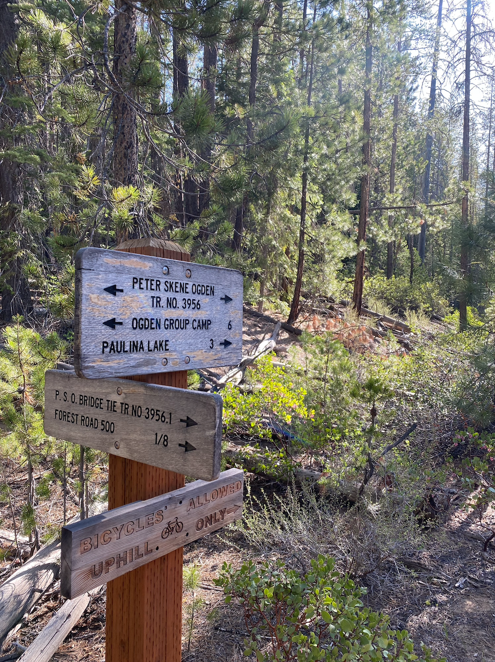
Junction with Forest Road 500
Both McKay Crossing and Forest Road 500 could be alternative starting points.
Around mile 6.25 there is a pitchfork in the trail with three options to choose from. The hard right takes you down to a beautiful waterfall, the middle one that looks like it ducks straight into the trees keeps you on the trail to Paulina Falls and the one on the far left ends up on a Forest Road.
Junction with Forest Road 500
Pitchfork in the Road
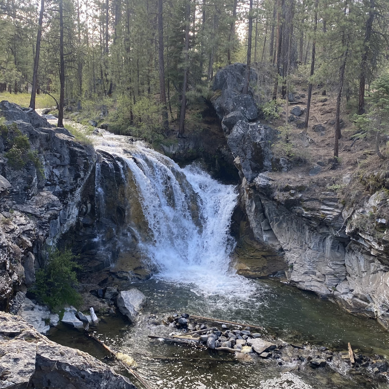
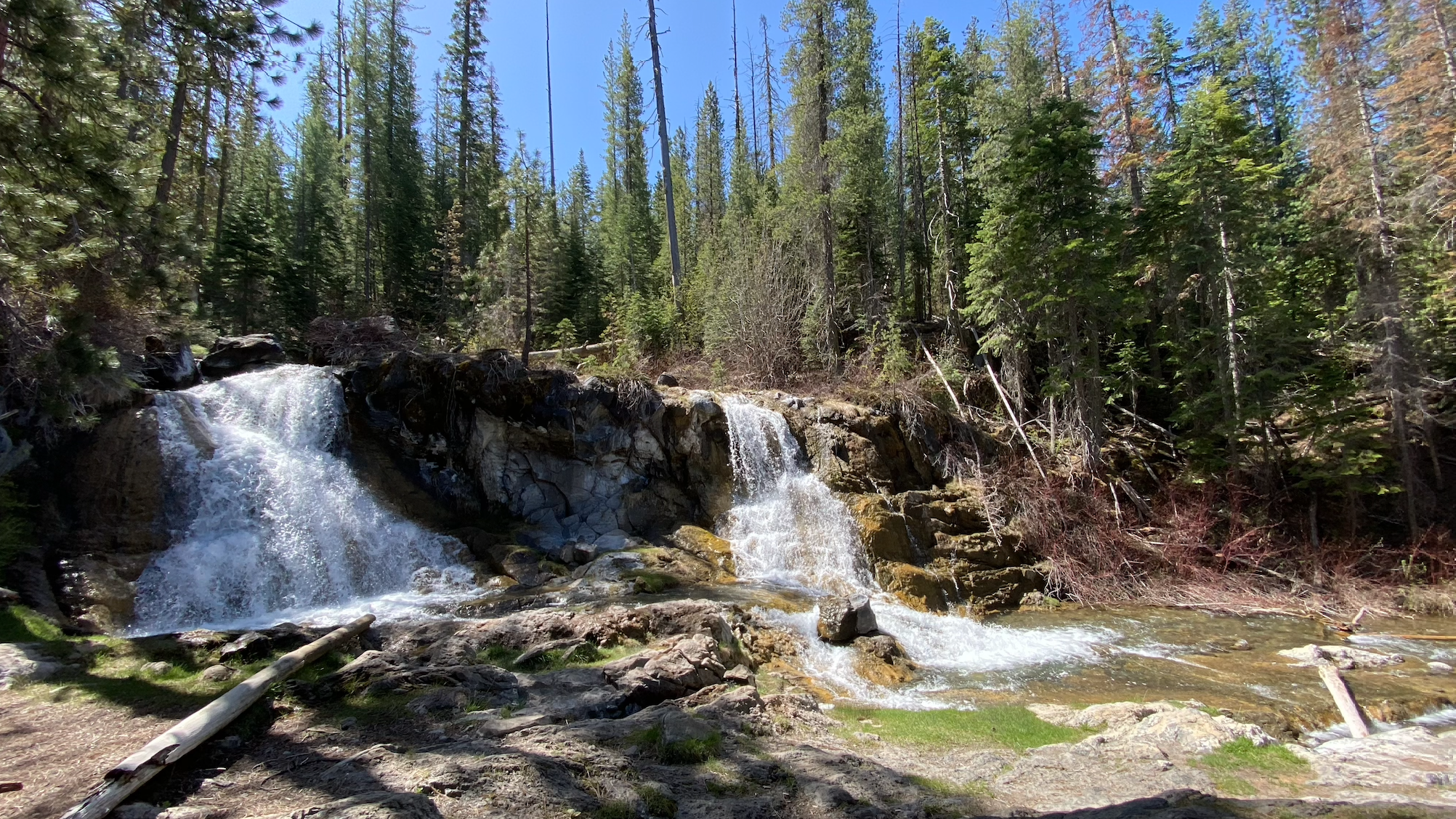
Take the middle option and keep climbing uphill into the trees all the way to Paulina Falls. Around mile 8.5 you will reach Paulina Falls, Paulina Lake is only another 3/10ths of a mile or so past the Falls and worth it to tack on the extra little bit if you have time! I’m used to seeing Paulina Falls as a large, rushing waterfall in the winter when I cross country ski up to it, so it was a bit surprising to see how little water was flowing over the falls. Still, it was quite beautiful. After a quick photo of the Falls, dogs and I descended the trail for a nice, cruiser 8.5 downhill miles back to the trailhead.
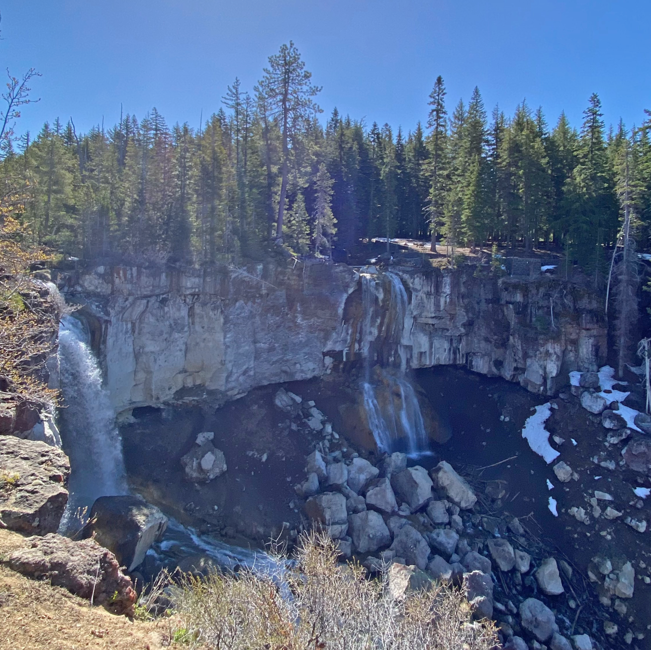
Paulina Falls
**NOTE! Bikes are allowed on this trail for uphill travel only. If running isn’t your game, but Mountain Biking is, this trail could be a lot of fun. Bikes can descend via the paved Forest Road 21, or string together a downhill adventure on the dirt/gravel Forest roads.
Gear:
- Shoes: La Sportiva Mutant
- Socks: Darn Tough Prism running socks
- Running Vest: Salomon Active Skin 8 + Salomon soft flask with XA Filter
- Shirt: Outdoor Research Echo Sun Hoodie
- Shorts: Territory Run Co. Long Haul Shorts
- Hat: Territory Run Co. x Mountain Shop custom Long Haul Cap
- Self-defense: Bear Spray with holster (it fits in my running pack!)